Recent searches
Search options

#Etna
2 posts2 participants0 posts today


Short update - Mt Etna, Sicily - 29.03.2025
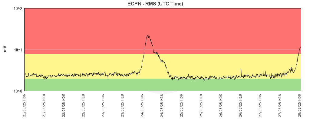
In the last 14 days, further Strombolian episodes have occurred at the South East Crater of Mt Etna:
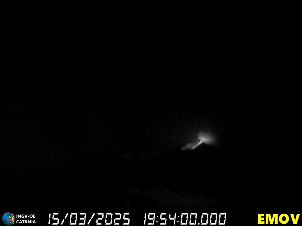
Accompanied by strongly increasing tremor, weak Strombolian explosions were visible at the former saddle vent of the South East Crater on the evening of 19 March. The vent located above the large southern breach continued to increase its activity until midnight and finally powerful Strombolian explosions hurled glowing material onto the southern and eastern flanks of the New South East Crater cone. Further vents on the upper north-west flank of the cone also became active. After about 02:30 the intensity of the explosions decreased again and at sunrise the activity was already significantly reduced.
A similar episode began on the morning of 24 March, but it took place in very bad weather. The fading Strombolian activity at the South East Crater could only be observed in the evening.
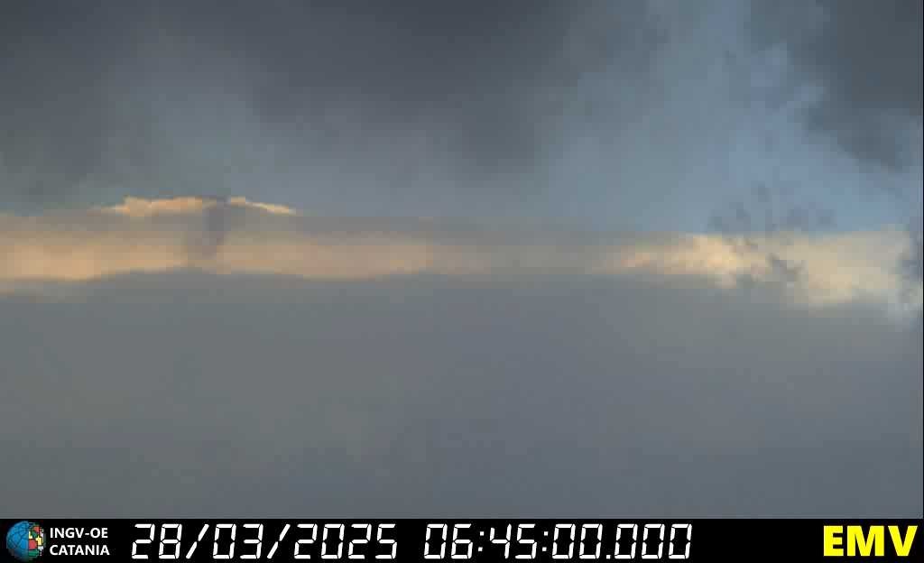
Another Strombolian episode is likely to have occurred on 28 March, as the tremor again increased sharply for a few hours, but dense clouds and fresh snow prevented any observation via webcams.
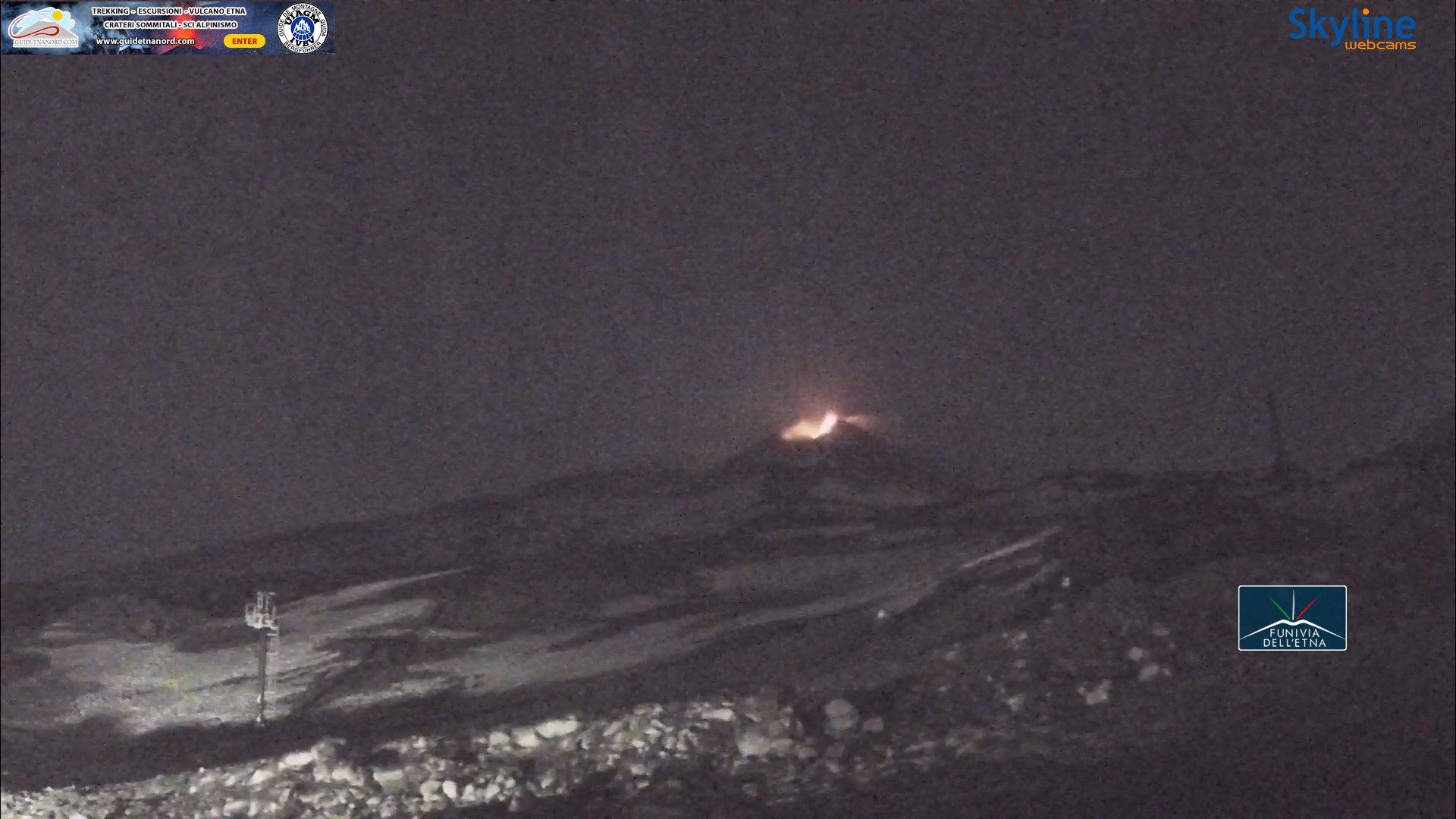
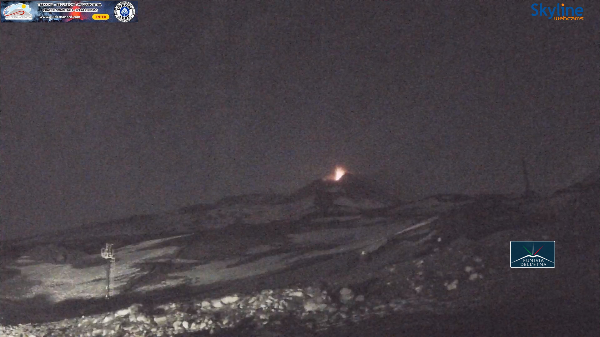
This INGV-webcam photo shows the Strombolian activity at the South East Crater on the morning of 20 March. The explosions that began the evening before have already weakened:
. It is caused by glowing lava, which is ejected explosively from a vent.")


Short update - Mt Etna, Sicily - 16.03.2025
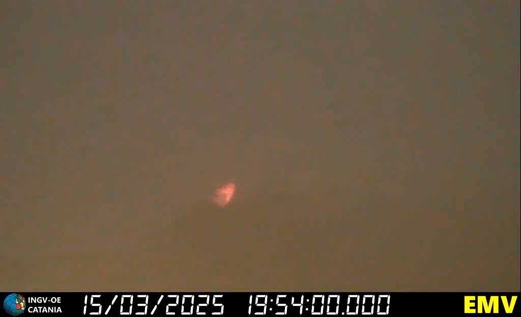
After almost 14 days of quiet gas emission at the summit craters, mild Strombolian activity suddenly began at Mt Etna's South East Crater on the evening of 15 March. During the night of 16 March, the activity increased significantly and there were some powerful Strombolian explosions. The event was accompanied by rapidly increasing tremor. On 16 March, the tremor fell back to a medium level and the eruptive activity came to an end.
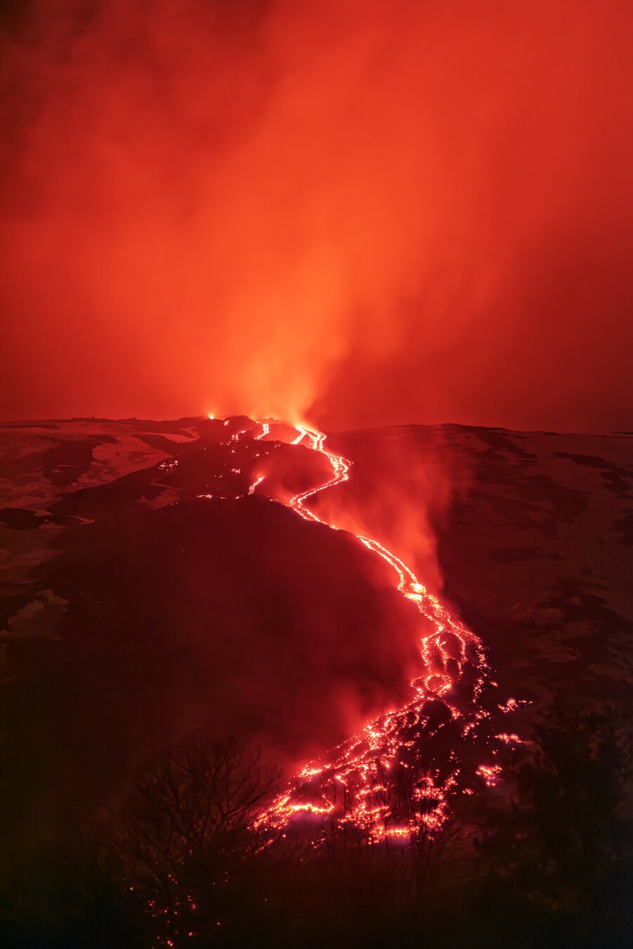
This INGV-webcam photo from the late evening of 15 March shows the strombolian activity at the South East Crater. The vent, which is located above the large southern breach, throws the glowing pyroclastic material about 100 metres upwards. Individual bombs reach the south-eastern base of the cone (lower right half of the image):


Amphitheatre, Ttaormina, the coastline of Giardini Naxos beyond. Mt. Etna would be in the picture, if it hadn't been shrouded in cloud that day.
#photography #Taormina #Sicily #GiardiniNaxos #Etna #amphitheatre


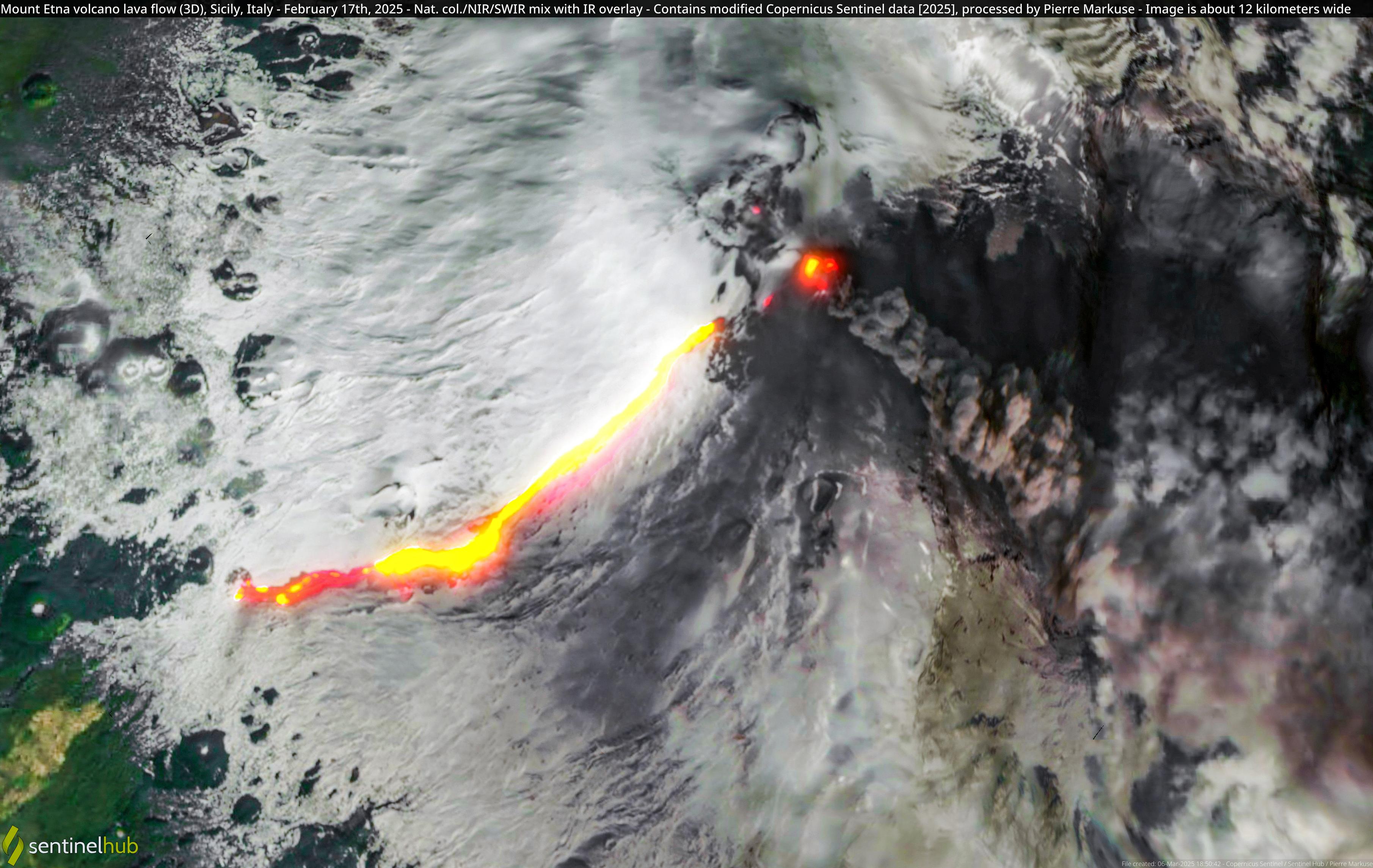
Mount Etna volcano lava flow (3D), Sicily, Italy - February 17th, 2025 

#3d #etna #etnavolcano #italy #landscape #lava #lavaflow #mountain
 1 new picture from @pierre_markuse https://commons.wikimedia.org/wiki/File:Mount_Etna_volcano_lava_flow_%283D%29%2C_Sicily%2C_Italy_-_February_17th%2C_2025_%2854369315461%29.jpg
,_Sicily,_Italy_-_February_17th,_2025_(54369315461).jpg")

 Mount Etna volcano lava flow (3D), February 17th, 2025
 , #Sicily, #Italy
 #Copernicus
 #Sentinel-2 Full-size flic.kr/p/2qQqXhH #OpenData #SciComm #Volcano #Etna Image is about 12 kilometers wide @CopernicusEU @CopernicusECMWF

La costa lavica etnea, dai canyon sottomarini all’isola Ferdinandea
C’è uno scivolamento di tutto il versante orientale etneo verso il mare, che si realizza all’interno di un settore crostale che ha come binari il canyon di Fiumefreddo (a nord) e quello di Catania (a sud). Anche di questo si è parlato nell’incontro, “Geologia della porzione sommersa della costa lavica etnea”, promosso dalla Lega Navale Italiana di Catania (LNI), diretta da Salvatore […]
Leggi il resto: https://www.argocatania.it/2025/03/03/la-costa-lavica-etnea-dai-canyon-sottomarini-allisola-ferdinandea/


 tra le


My partner and I have volunteered for mountan rescue in Cumbria and the Highlands for more than 30 years and multiple call outs - but heat has only been a problem.a couple of times - in the summer and a retrieval of dehydrated walkers. This is a little different.
Having said that, high heels on Striding Edge (really!!!) was a novelty
Good luck to all and please sheeple, read the news!
https://www.theguardian.com/world/2025/feb/28/etna-eruptions-cause-despair-among-mountain-rescuers
The Guardian · High heels and risky selfies: Etna eruptions cause despair among mountain rescuers
Dopo giorni di #cielo coperto, finalmente la signora torna a farsi vedere nuovamente vestita di bianco.
#Etna
#28febbraio
#Etna
#28febbraio


I'm going to take advantage of the current #eruption on Mt #Etna to discuss some of the challenges of #modelling #lava flows. Buckle up (or just silence me) because this is going to be a long thread.
First of all, why do we want to model lava flows? The answer most definitely isn't «because we can», since —as I'm going to explain momentarily— we actually cannot. Still having an idea about how lava flows and sets in place is a powerful tool for the assessment (and possibly mitigation) of the associated #hazard and #risk: if we can tell how lava flows, we can tell which areas are going to be reached by the lava, and hopefully also improve the design of tactical and strategic actions that can be taken to minimize the damage.
(Of course, whether or not those actions will then be taken is an entirely different matter, but that's mostly politics, not science.)
1/