Recent searches
Search options

#dcwx
12 posts10 participants1 post today


Continued thread
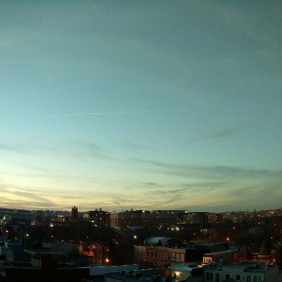
Mañana estará francamente tostado con máximos a mediados de los 80 y manteniéndose bastante cálidos a principios de semana, con una ligera caída en las temperaturas el martes a medida que avanza el frente; las posibilidades de lluvia seguirán siendo escasas o nulas hasta el final de la próxima semana. #RVA #Virginia #VAwx #MDwx #Maryland #DCwx

GIF


LWX continues Severe Thunderstorm Warning [wind: 60 MPH (RADAR INDICATED), hail: 1.50 IN (RADAR INDICATED)] for Augusta, Nelson [VA] till 8:45 PM EDT
https://mesonet.agron.iastate.edu/vtec/f/2025-O-CON-KLWX-SV-W-0027_2025-04-15T00:13Z
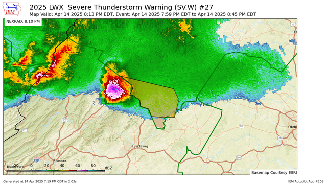
Iowa Environmental MesonetKLWX Severe Thunderstorm Warning #27Augusta, Nelson
LWX issues Severe Thunderstorm Warning [wind: 60 MPH (RADAR INDICATED), hail: 1.50 IN (RADAR INDICATED)] for Augusta, Nelson [VA] till 8:45 PM EDT
https://mesonet.agron.iastate.edu/vtec/f/2025-O-NEW-KLWX-SV-W-0027_2025-04-14T23:59Z
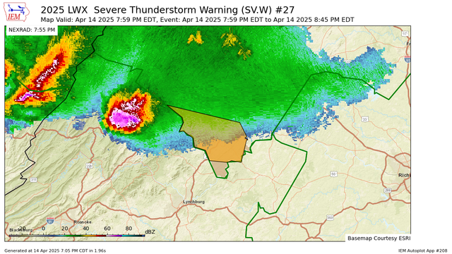
Iowa Environmental MesonetKLWX Severe Thunderstorm Warning #27Augusta, Nelson


LWX issues Frost Advisory valid at Apr 13, 2:00 AM EDT for Augusta, Nelson, Page, Rockingham, Shenandoah [VA] till Apr 13, 9:00 AM EDT
https://mesonet.agron.iastate.edu/vtec/f/2025-O-NEW-KLWX-FR-Y-0001_2025-04-13T06:00Z

Iowa Environmental MesonetKLWX Frost Advisory #1Augusta, Rockingham, Shenandoah, Page, Nelson


Partly to mostly sunny again tomorrow, then showers return Friday (mostly in the afternoon and evening, ending before midnight). Temperatures will hold in the low to mid 60s through Saturday, then a brief warm-up Sunday/Monday into the mid 70s, before our next front Tuesday brings clouds, spotty light showers, and cooler temperatures again mid to late week. #VAwx #MDwx #DCwx

